Duplicating
Tour copied successfully!

Places (POIs) visited during this tour

Place #1
Recommended Starting Point
Distance: 0.00mi
Map Pin
Cesar Chavez Mem Hwy, San Bernardino, CA 92407, USA
POI 1 Tour Image
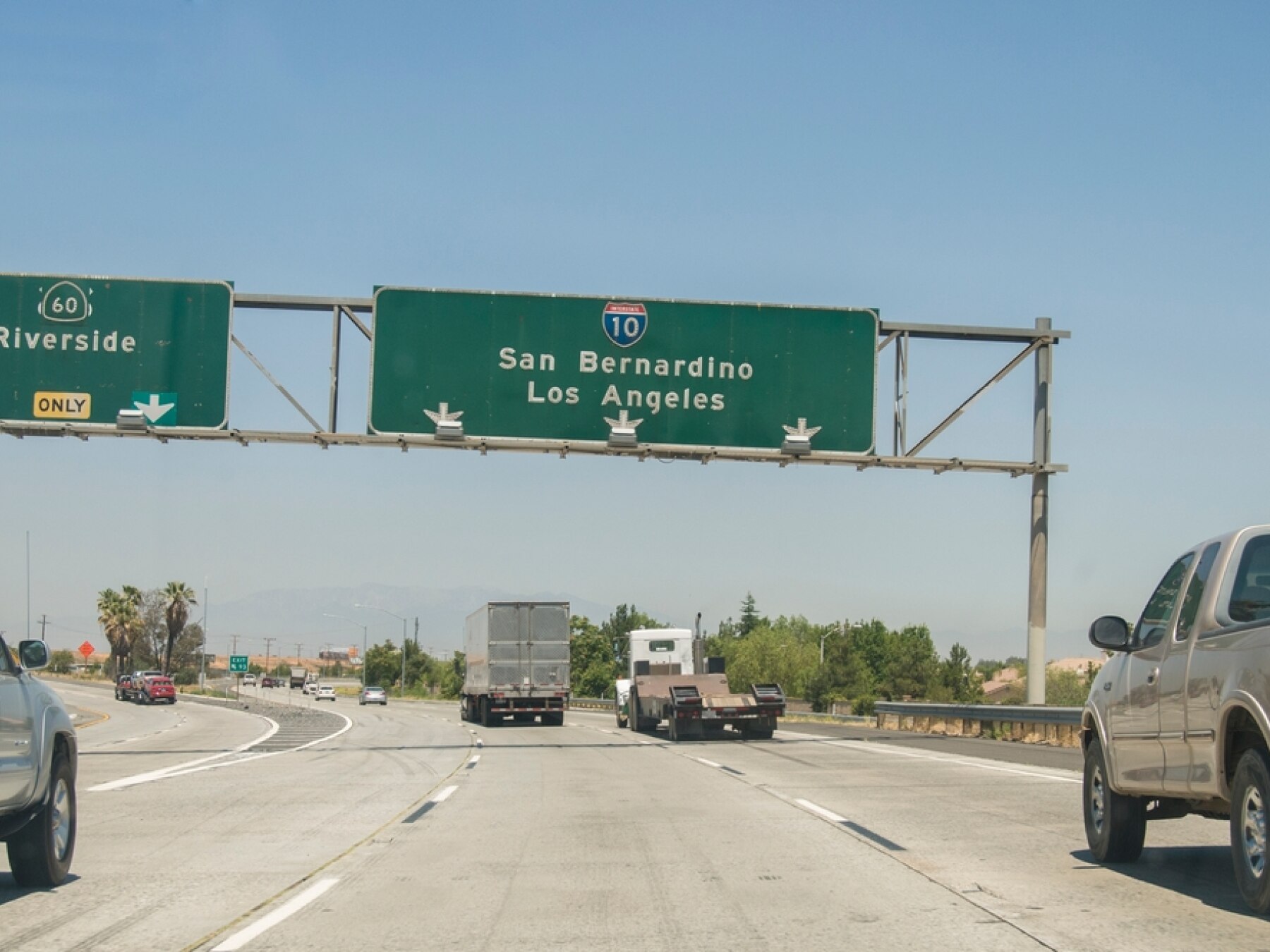
Goodbye San Bernardino — The Desert Is Calling
Goodbye San Bernardino — The Desert Is Calling. Our Route 66 journey is about to change dramatically.

San Bernardino historically served as an important gateway between Southern California and the desert beyond. From here, the old road headed toward Cajon Pass, Victorville, Barstow and eventually across the Mojave toward the Colorado River.

Those names may not sound as famous as Hollywood or Beverly Hills, but for Route 66 travelers, this is where things get really interesting.

The cities will begin thinning out. Mountains and desert will take their place. And we'll start encountering the roadside businesses, tiny communities and long abandoned stretches of highway that helped create the Route 66 legend.

So let's get going.

Flagstaff is a long way from here, and we've got a lot to see.
Place #2
Distance: 15.57mi
Map Pin
I-15, San Bernardino, CA 92407, USA
POI 2 Tour Image
Cajon Pass — Gateway to the Mojave
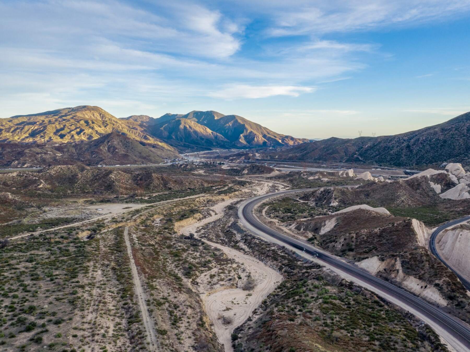
We're now approaching Cajon Pass, one of Southern California's great natural transportation corridors.

For centuries, this gap between the San Bernardino and San Gabriel Mountains has provided a passage between the Los Angeles Basin and the Mojave Desert.

Long before Route 66, Indigenous peoples traveled through this region. Wagon roads, railroads and eventually highways followed.

And when Route 66 was established in 1926, it came through here too.

Imagine tackling this pass in an early automobile nearly a century ago — without air conditioning, modern brakes, reliable engines or the multilane highways surrounding us today.

For generations of travelers heading west, descending Cajon Pass meant California's great cities were finally getting close.

But we're going the other way.

We're climbing away from Southern California and heading toward the desert.

And once we're through these mountains, you'll see just how quickly the landscape changes.
Tour itinerary stops | Additional places you'll see on this self-guided tour

Map Pin Place 1 Goodbye San Bernardino — The Desert Is Calling
Map Pin Place 2 Cajon Pass — Gateway to the Mojave
Map Pin Place 3 Victorville — Route 66 Reaches the High Desert
Map Pin Place 4 California Route 66 Museum — The Mother Road Remembered
Map Pin Place 5 Elmer's Bottle Tree Ranch
Map Pin Place 6 Barstow — Railroads, Route 66 and the Mojave
Map Pin Place 7 Route 66 Motel — Sleeping on the Mother Road
Map Pin Place 8 Into the Mojave — Route 66 Gets Lonely
Map Pin Place 9 Newberry Springs & the Bagdad Café — A Route 66 Movie Star
Map Pin Place 10 Ludlow — A Town the Highway Left Behind
Map Pin Place 11 Bagdad — The Route 66 Town That Disappeared
Map Pin Place 12 Across the Empty Mojave
Map Pin Place 13 Mojave National Preserve – California
Map Pin Place 14 Road 40 – Between Mojave National Preserve and Stepladder Mountains Wilderness
Map Pin Place 15 Welcome to Needles, California
Map Pin Place 16 Crossing the Colorado River — Welcome to Arizona
Map Pin Place 17 Historic Route 66 Back Country Byway
Map Pin Place 18 Oatman Highway Scenic View
Map Pin Place 19 Entering Oatman’s Mining Country
Map Pin Place 20 Mohave County Route 66 Sign
Map Pin Place 21 Welcome to Oatman — Gold, Burros & Route 66
Map Pin Place 22 Climbing Out of Oatman
Map Pin Place 23 Pipeline Road Scenic Overlook
Map Pin Place 24 Sitgreaves Pass Viewpoint
Map Pin Place 25 The Road Opens Toward Kingman
Map Pin Place 26 Kingman, Andy Devine Avenue & the Route 66 Museum
Map Pin Place 27 Life Along the Old Road
Map Pin Place 28 Peach Springs, Arizona – Heart of the Hualapai Nation on Route 66
Map Pin Place 29 Burma-Shave Signs
Map Pin Place 30 Welcome to Seligman — Where Route 66 Made a Comeback
Map Pin Place 31 Camp Picacho Area – Guns, Ghosts, and Getaways in the Mojave's Forgotten Outpost
Map Pin Place 32 Bill Williams Mountain
Map Pin Place 33 Welcome to Williams — The Last Town on Route 66
Map Pin Place 34 Farewell — On to Flagstaff


This is a premium tour, click below for complete access!

 
How to take a UCPlaces tour
Taking a UCPlaces tour is fun and easy.
Download the app (Android or iOS), purchase the tour (either here on the website, or from within the app).
That's it, you're ready to go!
When you want to start the tour, find the tour in the app (via a quick in-app search or by clicking the tour link received in your confirmation email) and click "Start Tour" (headphones recommended for best experience.)
* After purchasing a tour you will receive a purchase confirmation email including the tour link and instructions on how to take the tour, so you don't have to remember anything now.
How does the tour work?
UCPlaces acts as your personal tour guide, providing self-guided audio tours fully navigated within our app using GPS-based navigation. You won't need to switch between external navigation apps.
Whenever you approach a point of interest (POI) on the tour, our app will automatically play the relevant audio story at the right time and place.
If you start the tour before reaching the first POI, the app will navigate you to the starting point and then begin the tour.
How is this more convenient than a traditional tour?
UCPlaces offers an innovative and flexible way to explore exciting destinations on your terms.
Here are some key advantages over traditional tours:
  • No need to commit upfront or purchase in advance; buy a tour only when you're ready to go.
  • Walk at your own pace.
  • No waiting for groups; go on your schedule.
  • Take the tour in your preferred language.
  • Start, stop and continue the tour whenever you want.
  • Returning to the same destination? Take the tour again, and again, and again... And bring a friend!
  • Enjoy preferred prices.

What's included?
  • A self-guided audio tour taken via the UCPlaces app [iOS (iPhone) / Apple CarPlay / Android / Android Auto].
  • Tour route map and in-app GPS navigation (via the UCPlaces app).
  • Audio stories for places visited during the tour.
  • Apple CarPlay connection (iOS users) and Android Auto connection (Android users); for a seamless driving tour experience.
What's NOT included?
  • Earphones (highly recommended).
  • Smartphone.
  • Any kind of transportation (including tickets and passes).
  • Tickets to the attractions on your tour.
  • Food and drinks
  • Physical tour guide.

Have any questions about this tour? Or a general travel / self-guided tours question? That's completely natural

+ How long does this tour take?
Most travelers complete this tour in approximately 8 to 10.5 hours, depending on pace, time spent at each stop, and optional detours. Having said that, please remember that self-guided tours are extremly flexible (you can start, pause, continue anytime) and everyone has their own pace.
+ What does this tour include?
This self-guided driving tour includes 35 stops, covering top attractions such as Goodbye San Bernardino — The Desert Is Calling, Cajon Pass — Gateway to the Mojave, Victorville — Route 66 Reaches the High Desert, California Route 66 Museum — The Mother Road Remembered, Elmer's Bottle Tree Ranch.
+ Where does the tour start?
The tour starts at Goodbye San Bernardino — The Desert Is Calling (Address: Cesar Chavez Mem Hwy, San Bernardino, CA 92407, USA). You can begin the tour there or join from any stop along the route.
+ What type of tour is this?
This is a self-guided driving tour designed to be completed by car, covering scenic routes, city highlights and optional key stops.
+ Can I do this tour at my own pace?
Yes, this is a self-guided driving tour, so you can start anytime and explore at your own pace. You can pause, skip stops, or spend more time at places that interest you. You can even split it into multiple days. Explore however feels right for you. The only vaiables that might affect your pace are speed limits and traffic congestion.
+ Do I need a car for this tour?
Yes, this is a driving tour, designed to be completed by car, with stops spread across different locations connected by a driving route.
+ Do I need anything in order to take the tour?
There are two things that you need - <b>1.</b> A mobile phone (with the UCPlaces app installed and active location services, and a cellular data plan with a decent signal for downloading the tour). <b>2.</b> A car. Here are some recommendations for a great experience: 1. Make sure your phone is fully charged and bring a charging cable for your car. 2. Connect your phone to the car speaker system via bluetooth or use our CarPlay/Android Auto option for the best experience.
+ How will I navigate from point to point during the tour?
The tour uses GPS-based navigation through the UCPlaces app, with automatic audio playback and step-by-step directions between stops. This works great either directly from your phone, or while connected to your car's multimedia system and using our CarPlay or Android Auto options. Just follow the route and listen to the audio guide. Use the resume feature to continue from where you recently stopped (or closed the app). Easily skip or go back to stops.
+ Is this tour suitable for families or groups?
Yes, self-guided tours are ideal for families and small groups, allowing everyone to explore comfortably without being tied to a fixed schedule.
+ What makes a self-guided tour better than a guided tour?
Self-guided tours are more flexible, affordable, and personalized. You can avoid crowds, choose your pace, and focus on the stops that interest you most.
+ I installed the app and it's now asking for GPS and media access permissions, why?
The app is your tour-guide, it needs to know where you are located on the map to be able to trigger the points of interest. It also needs access to audio and media files to provide you with this experience.
+ What happens if there are unexpected roadblocks or navigation issues?
We have been working hard to deliver a great experience. Though you may run into unexpected obstacles (the world is constantly changing), our app has multiple features and mechanisms in place to help you overcome them, including: AI assistance, force play an audio if you can't reach the stop, skip or return to stops, automatic rerouting and more.
+ Can I take the tour in my language?
Though all of our tours are primarily in English, many tours are muyltilingual (including: Spanish, German, Portuguese, French, Japanese, Hebrew, French, Arabic and more...). The tour language options depend on the specific tour - You can easily check which languages are available in the tour screen!